For Assetto Corsa on PC · US roads
Draw a line on the map. Drive it within the hour.
StreetLap turns any road in the United States into a drivable Assetto Corsa track. It builds the real elevation from lidar, paints the road from aerial photos, and puts the buildings, trees and side streets where they actually are. You don't model anything.
One-time purchase. Windows 10 and 11. Unlimited tracks.
How it works
Three steps, and only the first one needs you
Draw your route
Search for a place and click along the roads you want. A loop around the block, a canyon road, the drive to work. The route snaps to real roads and follows one-way streets.
Press build
StreetLap downloads the elevation, aerial photos and map data for that area and builds the track on your PC. The first build of a 5 to 10 km route takes about 20 to 30 minutes, mostly downloading. Data is kept, so rebuilds take less than half that.
Drive
The finished track installs into Assetto Corsa for you, with pit boxes, an AI line and a track map. Open Content Manager and it is in the track list.
What gets built
The real place, from the data the government collects about it
Every track is built from public survey data, not guessed. Elevation comes from airborne lidar measured to about 10 cm. The road surface comes from aerial photos of that exact road.
Elevation you can feel
Climbs, dips, crowns and the camber of every corner, taken from the lidar survey. Drive the road at home and your brakes will know where they are.
USGS 3DEP lidar · ~1 m gridThe road as it looks
Patches, seams, lane lines and worn wheel tracks come from aerial photos of the road itself, then get sharpened with tileable asphalt, paint and concrete detail.
USDA NAIP 30–60 cm · county photos down to 7.6 cmBuildings at their real height
Footprints from OpenStreetMap, heights and roof shapes from the lidar, facades and roofs picked by building type. Houses look like houses, and the strip mall looks like the strip mall.
OpenStreetMap + lidar point cloudTrees where the trees are
Every tree the lidar sees is placed at its measured height and crown size, so the tree line in the game is the tree line you know.
Lidar canopy · per-tree heightRun wide and keep going
Side streets, the opposite carriageway, junctions, car parks and verges are all drivable and meet the road flush. Cut a corner and you will not fall into a hole.
Checked on every buildBuilt to run smoothly
Far detail is simplified and textures are packed and sized, so even a 10 km city track stays inside a fixed draw budget and loads like any other track.
Budget: 900 objects · 1.3 M triangles in viewBuilt tracks
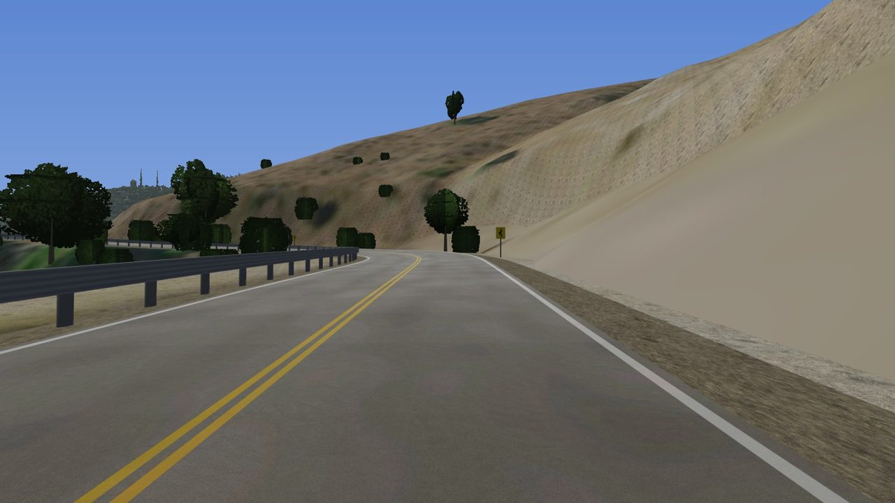
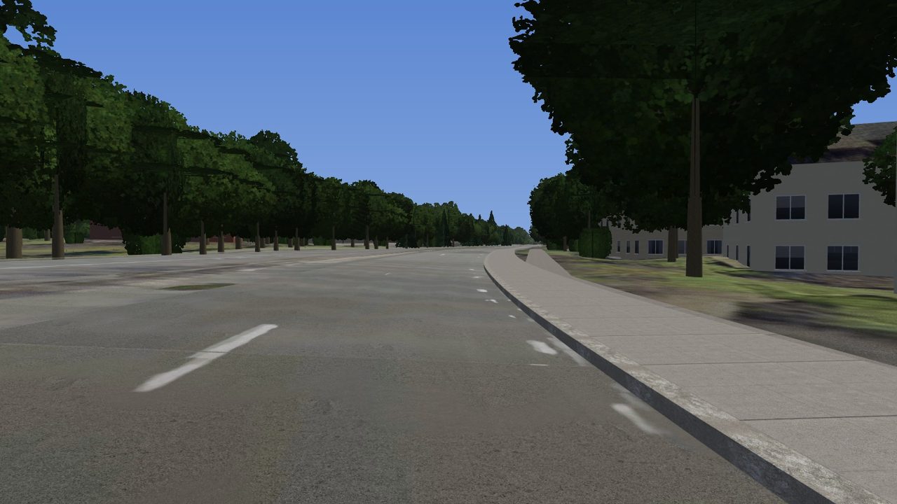
Two roads, two very different places
Quality checks
Every build is checked before you drive it
After each build, StreetLap maps every surface a car can reach, compares it with what you see, and tells you in plain words whether the track is ready.
- No holes to fall through, anywhere inside the walls
- What you see is what the tyres touch: no invisible bumps, no sinking
- Off-road ground checked for dips and steps you would feel
- Size and draw load compared with the last build of the same track
StreetLap 1.0
- Unlimited tracks, anywhere in the contiguous United States
- Circuits and point-to-point roads
- Automatic install into Assetto Corsa
- Free updates for version 1
- A refund if it can't build your road (see refunds)
Before you buy
What your PC needs
| System | Windows 10 or 11, 64-bit |
|---|---|
| Game | Assetto Corsa on Steam. Content Manager and Custom Shaders Patch recommended. |
| Processor | 4 cores minimum, 8 or more recommended |
| Memory | 16 GB |
| Graphics | Any card that runs Assetto Corsa (OpenGL 3.3 for the previews and checks) |
| Disk | 2 GB for the app, plus 1 to 3 GB per track and its data cache |
| Internet | Needed while building, to download the map, elevation and photos |
Questions
Frequently asked
Which places can I build?
Any public road in the contiguous United States. The elevation and photo data StreetLap relies on is collected by US federal agencies and is free to use, which is why the US comes first. Other countries will follow where the same quality of data is openly available.
Do I need a Google Maps key or any other account?
No. Everything is downloaded from public sources while the track builds. There is nothing to sign up for beyond your licence key.
How long does a build take?
About 20 to 30 minutes the first time for a 5 to 10 km route on an 8-core PC, most of it spent downloading photos and lidar from US government servers. Rebuilding the same area reuses what was downloaded and takes under 10 minutes.
Does it work with Assetto Corsa Competizione or EVO?
Not at launch. Tracks are made for the original Assetto Corsa on PC. BeamNG.drive support is planned as a later update.
Can I share the tracks I make?
Yes, for free sharing with other players. Each track includes a credits file listing the data it was built from, and that file needs to stay with the track. Selling tracks is up to you and the terms of the data used; we can't clear that for you.
How accurate is it?
Road height comes from lidar with a typical vertical accuracy of about 10 cm. Road position comes from OpenStreetMap and is checked against the aerial photo. Building heights come from the lidar where it covers them. The build report lists every source and its date for your track.
What if my road doesn't build well?
Send us the route from the app's support button. If StreetLap can't build a drivable track of it, you get your money back within 14 days of purchase.